When Your Maps Can't Keep Up With Your Mission
The Dubuque County Conservation Board manages 20 distinct park properties across the county—a mix of hiking trails, biking paths, golf courses, camping facilities, and natural preserves. Each property serves as a gateway to outdoor recreation and environmental education, drawing thousands of visitors annually who rely on maps to navigate unfamiliar terrain.
But DCCB faced a challenge common among county conservation boards: they had no consistent mapping system. Without dedicated cartography staff or professional design software, maps were created ad-hoc using whatever tools were available—Microsoft Publisher stretched beyond its limits, blurry GIS imagery printed as-is, inconsistent iconography, and outdated trail information. The result was a fragmented wayfinding experience that undermined the professionalism of their conservation work.
When trails changed, amenities were added, or seasonal closures occurred, updating maps became a logistical nightmare. Different parks used different visual languages. Information density varied wildly. Some maps were accurate; others hadn't been updated in years. For an organization dedicated to preservation and public service, their maps weren't serving the public well enough.
DCCB needed more than a redesign—they needed a design system that could scale across all 20 properties, remain accurate as conditions changed, and be maintained without requiring a full-time cartographer on staff.
Where Geographic Precision Meets Design Thinking
The solution required bridging two worlds: the technical precision of GIS data and the clarity of information design. DCCB had been meticulously tracking their trail systems using GIS tools, collecting GPX files that captured every turn, elevation change, and junction. That spatial data was gold—but it lived in a format that couldn't communicate directly with park visitors.
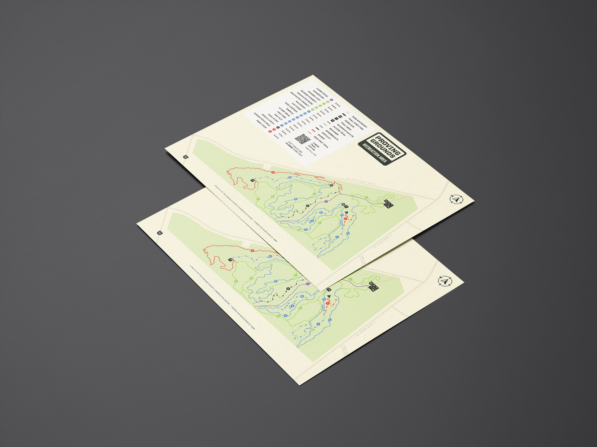
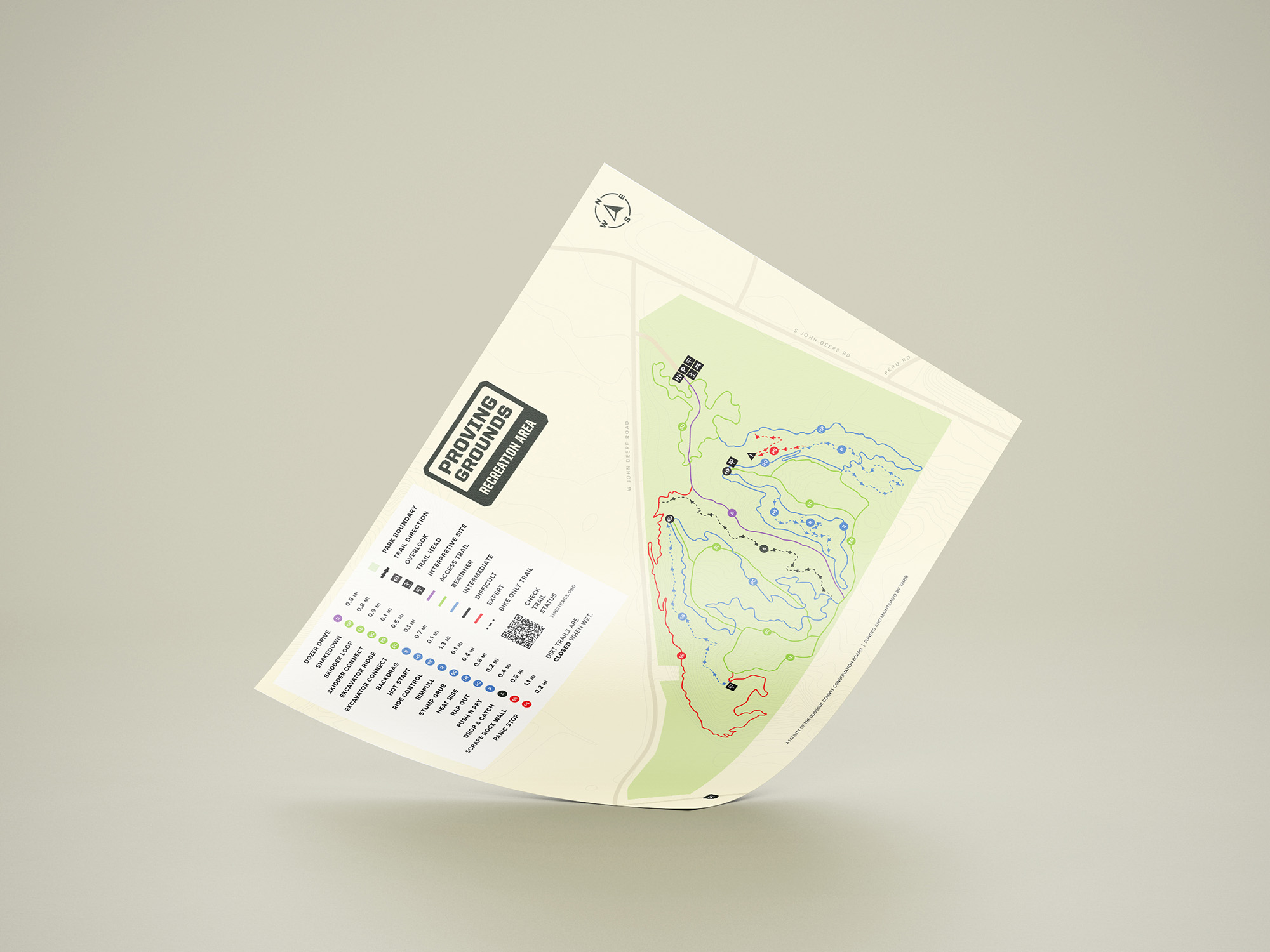
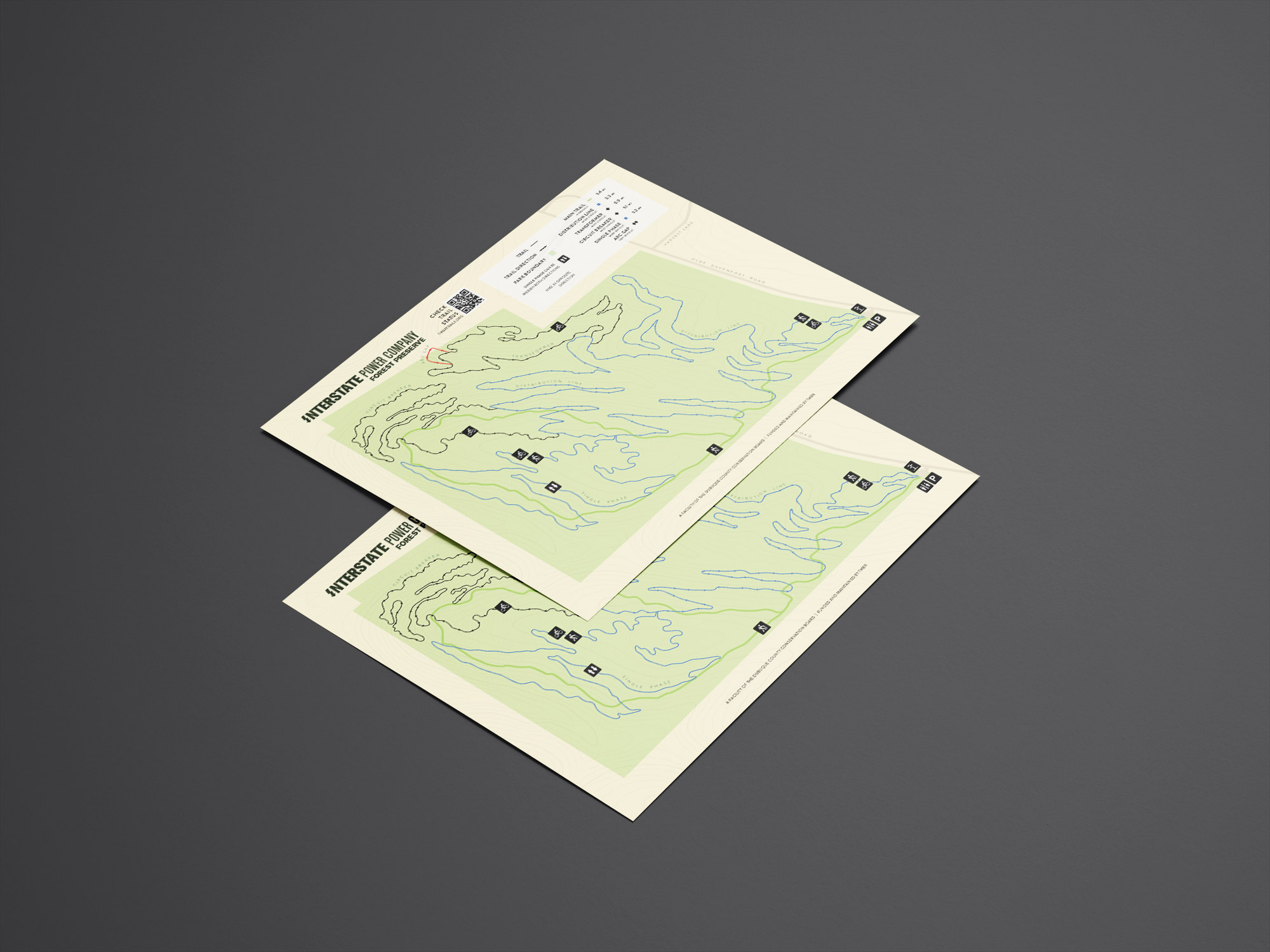
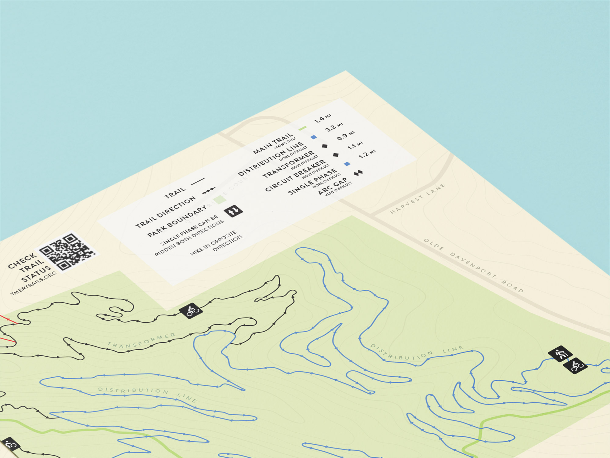
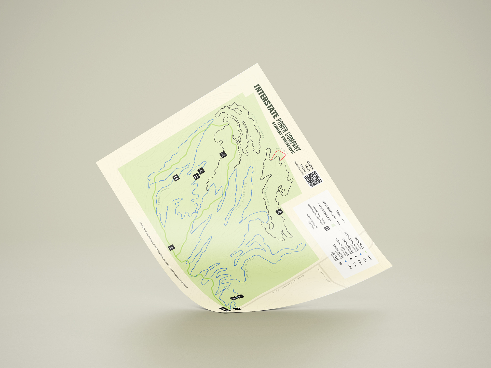
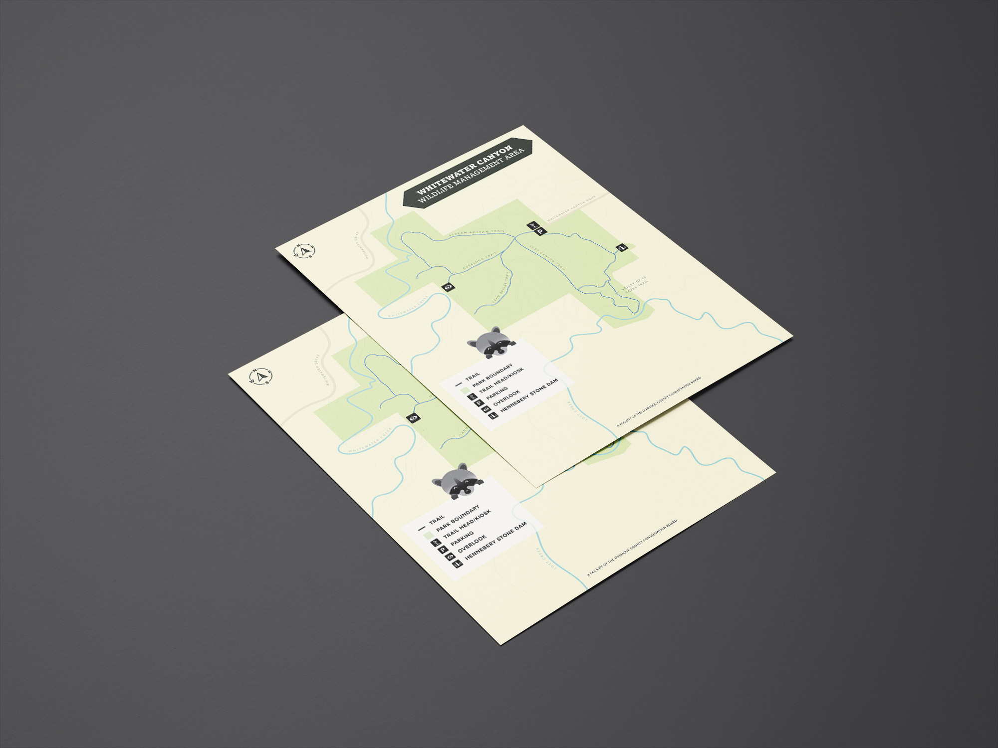
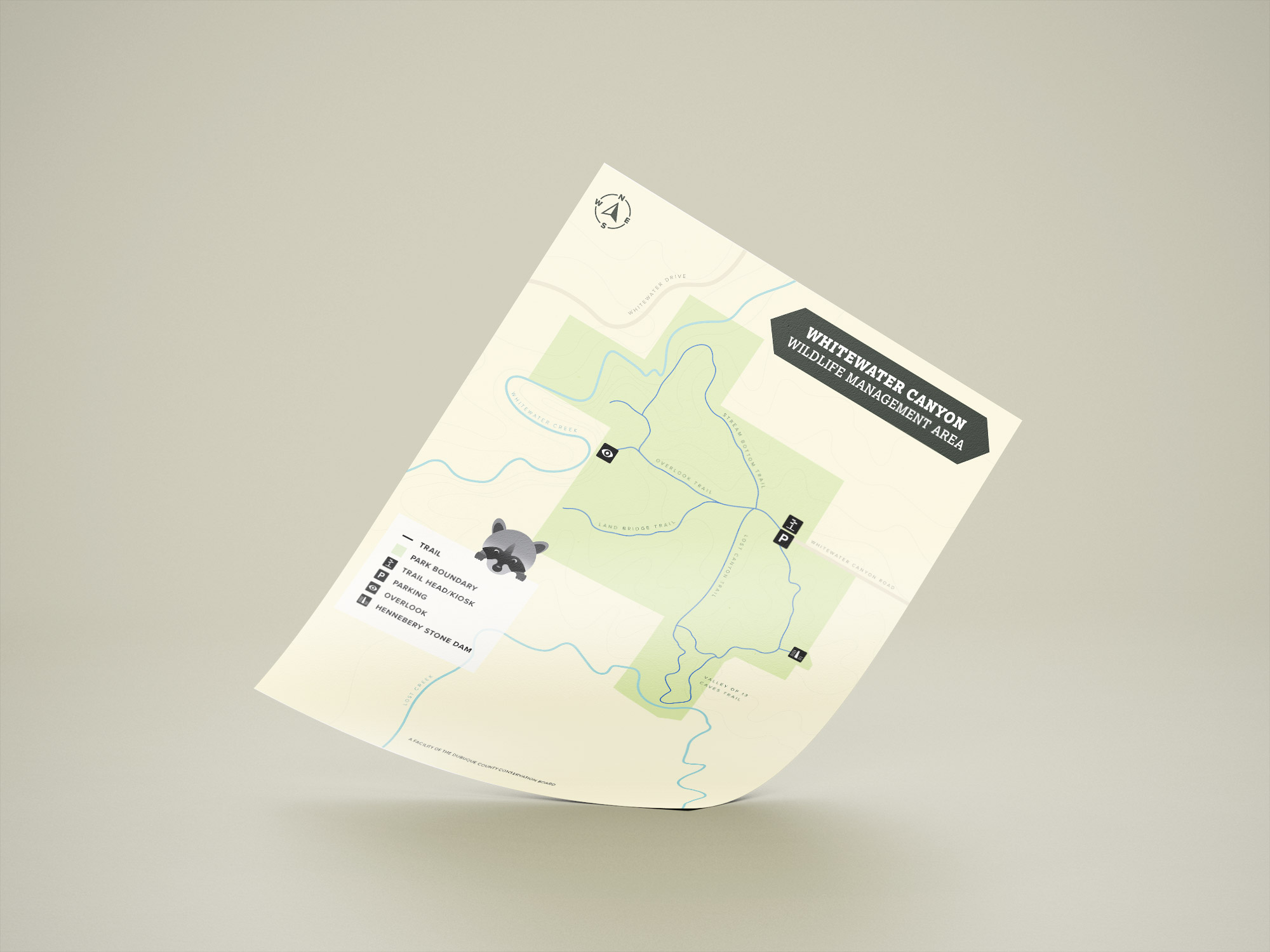
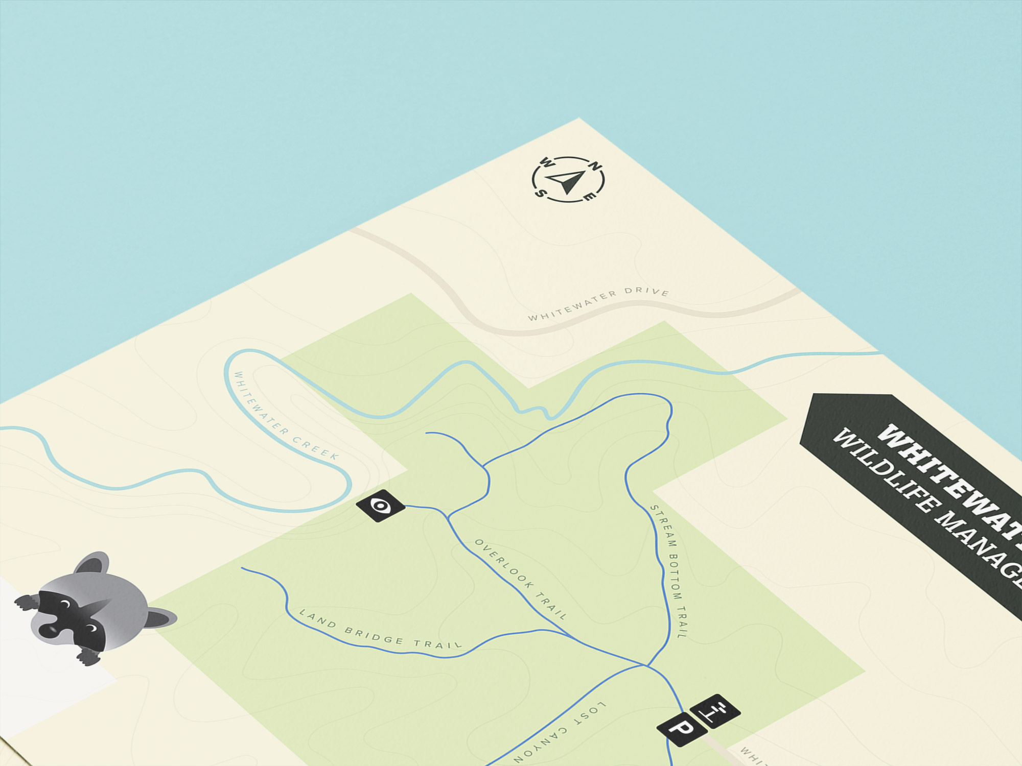
Our process began by integrating multiple GIS platforms into a design workflow. Using ArcGIS and OpenStreetMap data as base layers, we imported DCCB's GPX trail files to ensure geographic accuracy. The MAPublisher plugin for Adobe Illustrator became the bridge, allowing us to work with precise geospatial data while maintaining full creative control over the visual output. Every trail, trailhead, parking area, and amenity was positioned exactly where it exists in the real world.
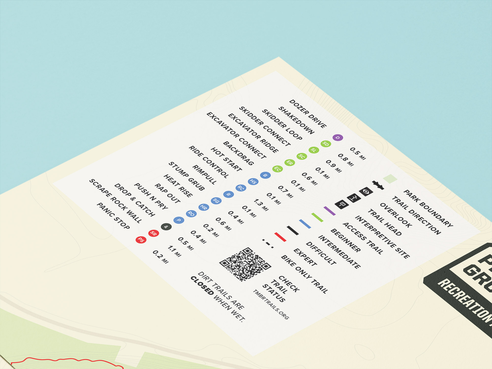
But accuracy alone doesn't make a useful map. The design system we developed addressed the fundamental challenge of legibility across contexts—from large trailhead kiosks to pocket-sized printed guides. We established a color hierarchy that separated trail types (hiking, biking, multi-use) while maintaining visual harmony across all 20 properties. Line weights and dash patterns were calibrated to remain distinct at any scale. Typography was selected not just for aesthetics but for readability at distance, considering factors like viewing angles and outdoor lighting conditions.
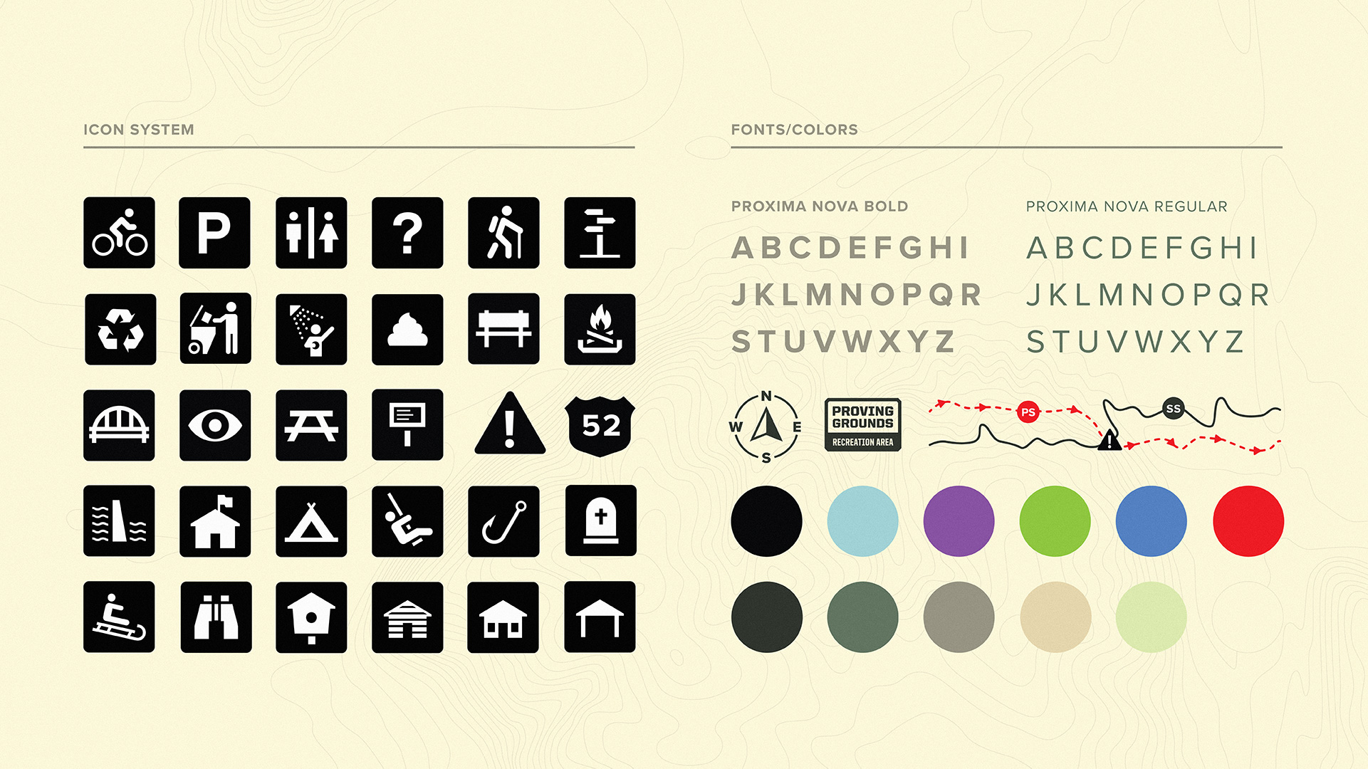
The icon system became the visual backbone of the entire project. We designed a comprehensive set of amenity icons—camping, fishing, restrooms, parking, picnic areas, boat launches, and more—that could be instantly recognized regardless of which park a visitor was exploring. Every icon was tested for clarity at multiple sizes and refined until it worked as well at thumbnail scale as it did at full size.
Spacing and information density were carefully controlled. Too sparse and the map wastes space; too dense and it becomes overwhelming. We developed a grid system and proximity rules that ensured consistent, breathable layouts across all properties, regardless of their complexity.
A System Built to Last
The new mapping system transformed how DCCB communicates with park visitors. All 20 properties now speak the same visual language, creating a cohesive brand experience that reinforces trust and professionalism. When someone visits one DCCB park and then explores another, they immediately understand how to read the map—no learning curve, no confusion.
More importantly, the system is maintainable. Because it's built on DCCB's existing GIS data infrastructure, updates can flow directly from their trail tracking tools into the design files. When a new trail segment opens or an amenity location changes, the spatial accuracy remains intact. The design system's modular structure means individual park maps can be updated without rebuilding the entire system from scratch.
The measurable impact extends beyond aesthetics. Park staff report fewer wayfinding questions from visitors. Trail misuse has decreased as clear maps guide people to appropriate routes. Emergency services have more accurate reference materials when responding to incidents on park property. And DCCB now has a professional asset library they can use across print materials, digital platforms, and wayfinding signage.
Deliverables:
- Comprehensive mapping system design standards
- 20 individual park map designs
- Custom iconography library (25+ icons)
- Color system and typography guidelines
- Modular design templates for future updates
- Integration workflow documentation for GIS-to-design pipeline
The project demonstrates what becomes possible when GIS technology and design expertise converge. Spatial data provides the foundation of truth; design systems provide the clarity to communicate it. For conservation boards managing complex properties with limited resources, this approach offers a path forward—accurate, maintainable, and built to serve the public for years to come.
Ready to transform how your organization communicates spatial information?
Looking for design and mapping services for your parks, preserves, and recreation areas? You've come to the right place.
Click the buttons below to schedule a free consultation or get a project quote today. We're looking forward to working with you!